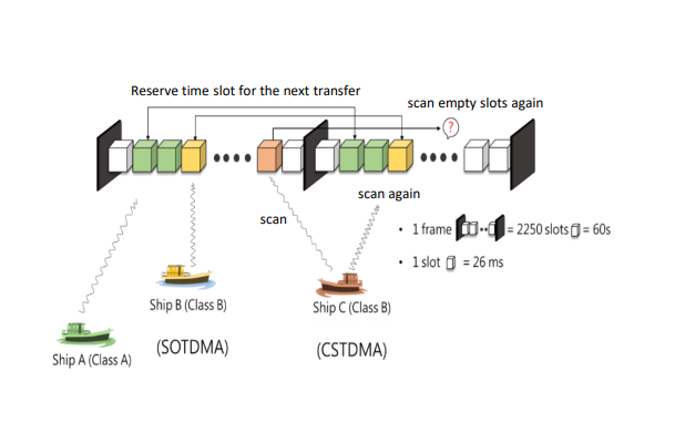
Figure 1. AIS communication transmission
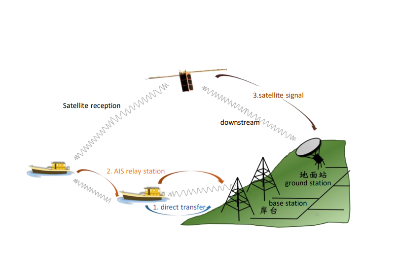
Figure 2. Introduction to the data sending and receiving of AIS ships, land and satellites
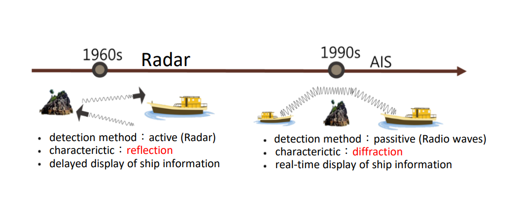
Automatic Identification System (AIS) is a maritime information exchange and identification system commonly used between ‘ships and ships’ and ‘ships and shore stations’.
In 2004, the International Convention for the Safety of Life at Sea (SOLAS) requires that “all cargo ships of 300 gross tonnage and upwards engaged on international voyages”, “cargo ships of 500 gross tonnage and upwards not engaged on international voyages” and “all passenger ships irrespective of size” must be equipped with AIS.
AIS includes a variety of transceiver equipment installed on land, ships, and satellites. It uses Global Positioning System (GPS) and Very High Frequency (VHF) radios to transmit ship-specific information to nearby ship's and shore station's automatic reporting systems.
The AIS system receives the dynamic, static and voyage-related information sent by the ship, such as ship name, call sign/MMSI, ship type, position, course to the ground, sailing status, destination and estimated time of arrival, number of people on board, etc.
In addition to broadcasting sea conditions and danger warning areas, AIS can also be combined with a maritime radar to avoid collisions in marine traffic, track marine pollution, predict marine trajectories, and calculate appropriate approach speed for landing, so as to effectively manage ships entering and leaving the port.